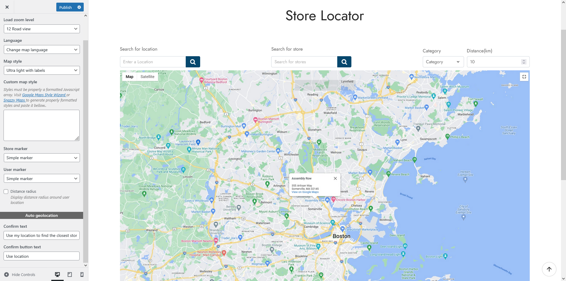
- Load zoom level: Set the default zoom level when the map loads. A lower number shows a wider area, while a higher number zooms in on specific locations
- Language: Select the language used for map labels and interface elements
- Map style: Choose from predefined map styles or custom one to match your website’s design
- Custom map style: If you choose “Custom” in Map style option, paste a properly formatted JavaScript array for a custom map appearance. Use tools like Google Maps Style Wizard or Snazzy Maps to generate styles.
- Store marker: Choose the icon used to represent store locations on the map. If you want to use custom maker, choose your own image
- User marker: Set the icon for the user’s current location on the map. If you want to use custom maker, choose your own image
- Distance radius: Display a circular radius around the user’s location to indicate the search range. If you enable,
- Inner radius color: Adjust color inside the border – between the border and the market, and the color opacity
- Border radius color: Adjust color of the border and drag/drop the range slider to change the color opacity
Auto geolocation
When enabled, the map will attempt to detect the user’s location automatically.
- Confirm text: Customize the message for confirmation
- Confirm button text: Set the label for the confirmation button